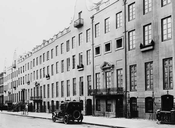
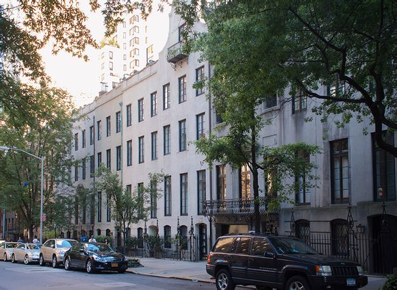
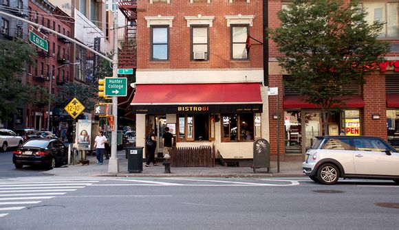
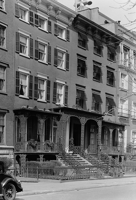
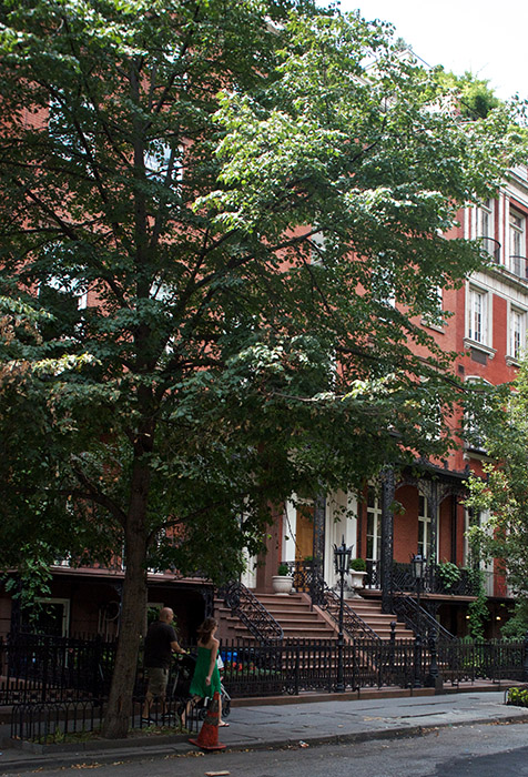
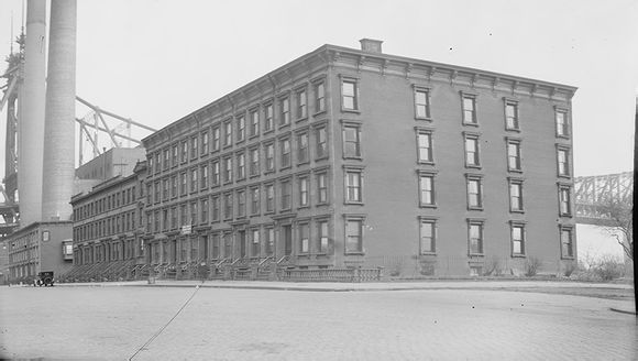
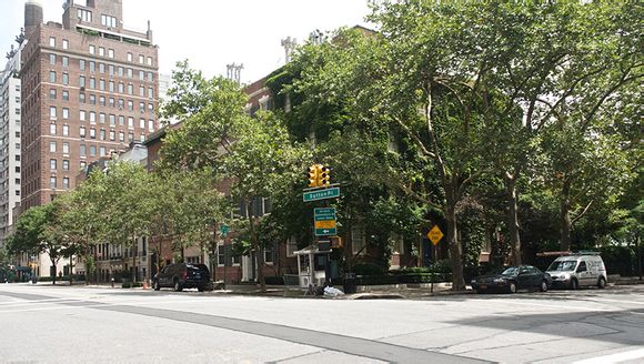
Before & After - The Turtle Bay Gardens
图说纽约的过去与现在
来源:金玉米 编辑:豪宅
时间:2015-03-31
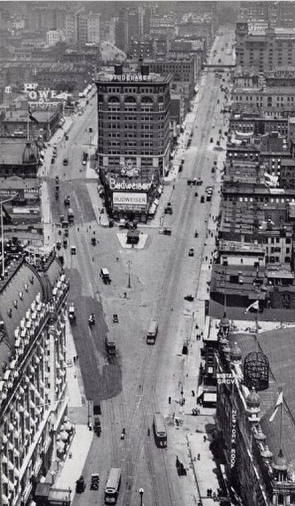
上世纪30年代纽约一景
The above photo is interactive. Drag the yellow handle in the middle to reveal more or less of the before or after image. Alternatively, you can simply click anywhere on the image to move the slider automatically.
Formerly a decrepit neighborhood covered in soot from nearby factories, and caged in by elevated trains on 2nd and 3rd Avenues, Turtle Bay exited the 20th century as one of the nicer neighborhoods in Midtown Manhattan. In 1918 Charlotte Hunnewell Sorchan purchased nearly the entire block of rowhouses between 48th & 49th Streets and 2nd & 3rd Avenues. She had them extensively renovated, faced with stucco and built quiet, secluded gardens in the middle. Having since been landmarked, the Turtle Bay Gardens have been home to many celebrity residents over the years. By the mid 20th Century the rise of the United Nation Headquarters and the fall of the elevated lines helped remove many of the unsavory elements nearby.
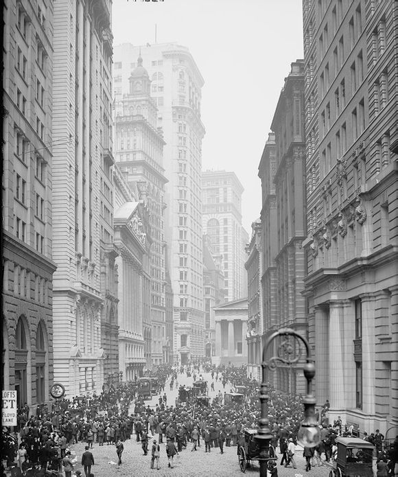
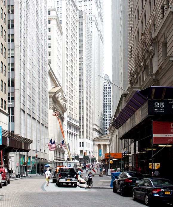
Before & After - Broad Street & The New York Stock Exchange
The above photo is interactive. Drag the yellow handle in the middle to reveal more or less of the before or after image. Alternatively, you can simply click anywhere on the image to move the slider automatically.
One of my favorite geographical fallacies is that of the New York Stock Exchange being on Wall Street. Sure, the building itself is right on the corner of Wall Street, but the main face and colonnade so often associated with the NYSE actually sits on Broad Street – a more impressive-looking street in my opinion, and one that often is misidentified as Wall. A more historic building, Federal Hall, sits on Wall Street proper and is visible from Broad. The steps of this building were the site of George Washington's first inauguration.
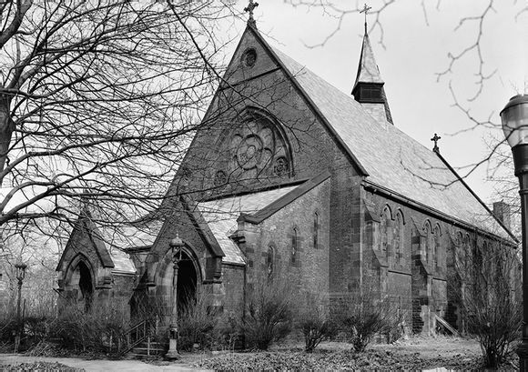
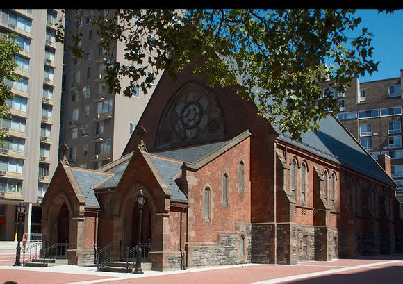
Before & After - Roosevelt Island, The Chapel of the Good Shepherd
The above photo is interactive. Drag the yellow handle in the middle to reveal more or less of the before or after image. Alternatively, you can simply click anywhere on the image to move the slider automatically.
Roosevelt Island is in a constant state of reinvention. It has hardly lasted more than 75 years with the same name – over the past 200 years it's been known as Minnehanonck, Varkens Eylandt, Blackwell's Island, Welfare Island, and Roosevelt Island. The mid-1970's saw the State of New York embark upon a planned community that represents the current incarnation of this 2-mile East River oddity. The Chapel of the Good Shepherd is one of only a handful of buildings that was erected prior to the 1970's (1888 to be exact). As the original four main apartment complexes sprung up around it, the Chapel became a de facto community center. The original 1970 photo shows an overgrowth of plants and trees that was representative of the deteriorating island and was probably shot for documentation purposes just before development of new community began.
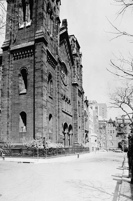
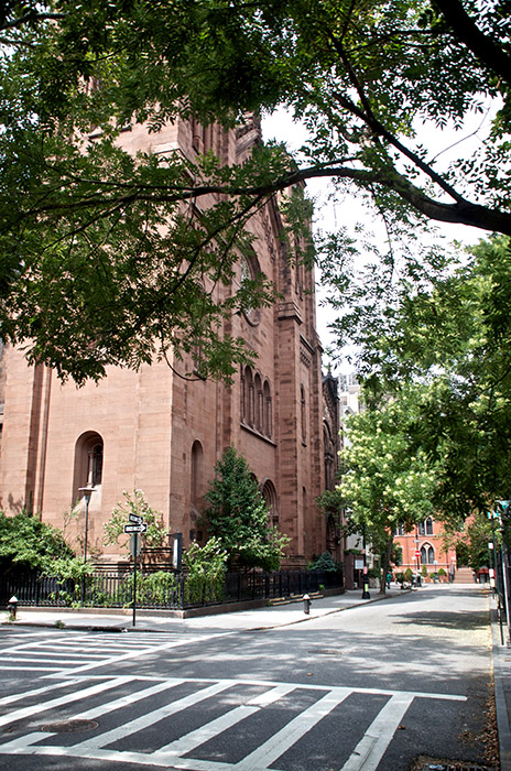
Before & After - St. George's Episcopal Church
1984
The above photo is interactive. Drag the yellow handle in the middle to reveal more or less of the before or after image. Alternatively, you can simply click anywhere on the image to move the slider automatically.
Known for many years as "Morgan's Church" thanks to parishioner J.P. Morgan, St. George's Episcopal Church has sat on the edge of Stuyvesant Square since the mid 1800's. Originally built with twin spires, they were removed in 1889, leaving the rather stunted appearance we have today. On the far right side of this picture you can catch a glimpse of Stuyvesant Square's original 1847 cast iron fence, which is the second oldest surviving fence in the city – after Bowling Green's
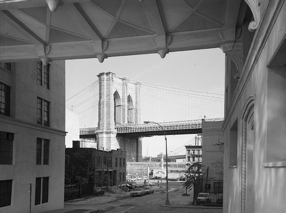
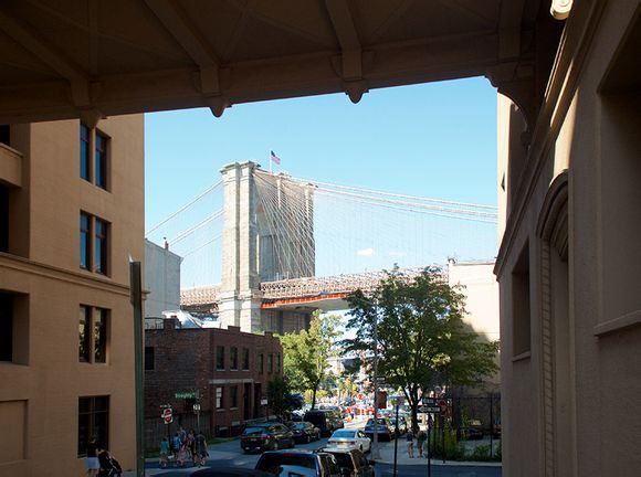
Before & After - Brooklyn Heights & DUMBO
The above photo is interactive. Drag the yellow handle in the middle to reveal more or less of the before or after image. Alternatively, you can simply click anywhere on the image to move the slider automatically.
On the northern-most edge of the neighborhood of Brooklyn Heights you can get your first glimpses of the Brooklyn Bridge. Framed by the Watchtower buildings, the bridge continues to be one of New York City's most popular tourist destinations. The neighborhood below the Brooklyn tower, part Brooklyn Heights / part DUMBO, has seen a resurgence in recent years with the creation of Brooklyn Bridge Park and the continued popularity of tourist attractions like Grimaldi's Pizza.
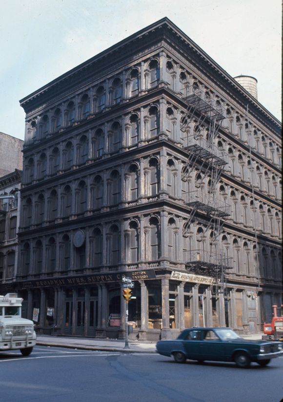
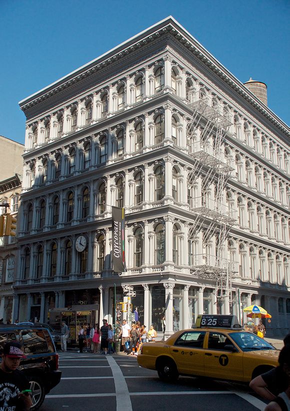
Before & After - SoHo, The Haughwout Building
![]()
![]() 1967
1967
The above photo is interactive. Drag the yellow handle in the middle to reveal more or less of the before or after image. Alternatively, you can simply click anywhere on the image to move the slider automatically.
The Haughwout Building is a unique landmark in many respects. Built in 1857, the corner building required two cast iron facades - which would normally be too heavy for structures of the time. The designer and builder convinced the owner of the building to allow them to use the cast iron decoration to support the building itself. This was a new engineering idea at the time. It would be another 50 or so years before steel-framed buildings expanded on the concept and spawned the skyscraper boom of the 20th century. Another skyscraper-friendly idea that was well ahead of its time was the inclusion of an elevator, installed by Elisha Graves Otis himself. It was powered by steam and was mostly a tourist attraction.
Before & After - Brooklyn Bridge
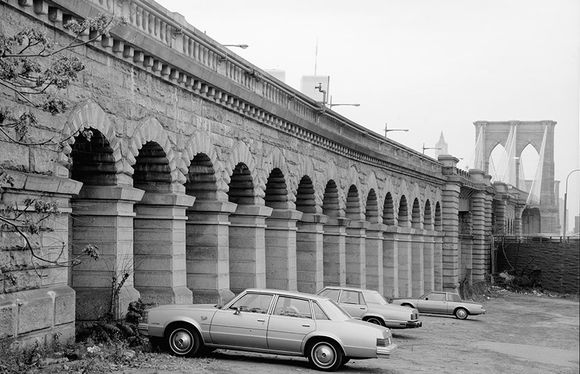
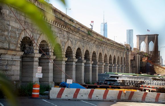
The above photo is interactive. Drag the yellow handle in the middle to reveal more or less of the before or after image.
The Brooklyn Bridge is so unique and beautiful thanks partly to its over-engineering. The diagonal cables that run from the towers down to the road deck actually don't serve the make the bridge any stronger, but over the years they've become one of the many iconic features of the crossing. Recently, old bridges like this one have come under scrutiny as the deteriorating infrastructure in the United States becomes a larger issue. Fortunately, much of the aforementioned over-engineering has helped keep the the main span of Brooklyn Bridge is relatively good shape. What hasn't fared as well are the approach ramps, which are currently undergoing a multi-year rehabilitation. In today's photo you can see that this parking lot on the Brooklyn side has been commandeered by this construction project as a staging place for some of their materials.
Also of interest is how much that sliver of Manhattan skyline has changed since 1982. 8 Spruce Street (AKA New York by Gehry, formerly Beekman Tower)has taken a domineering spot on the north end and of course One World Trade Center (AKA 1 WTC, formerly Freedom Tower) has replaced the Twin Towers.
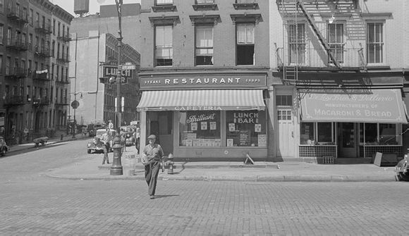
Before & After - 1st Avenue at 61st Street
The above photo is interactive. Drag the yellow handle in the middle to reveal more or less of the before or after image.
I love this photo because, unlike so many of the other Before & After posts, this one is completely unremarkable in terms of subject matter. While other photos have focused on popular neighborhoods or landmarks, this image is just a simple everyday street scene on the Upper East Side in the late 1930's. Of course I also love how persistant the building in the center has been over the decades! The creator of the original image is Walker Evans, a prolific photographer who is well known for his Depression-era work for the Farm Security Administration. His work for the FSA (approximately 1,000 large format negatives) is the only portion of his portfolio in the public domain as the rest of his work was handed over by his estate to the Metropolitan Museum of Art.
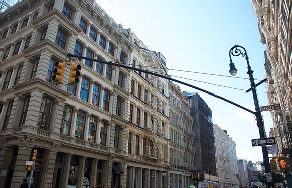
Before & After - SoHo at Mercer Street & Broome Street

The above photo is interactive. Drag the yellow handle in the middle to reveal more or less of the before or after image.
Throughout the 1940's and 1960's the neighborhoods that would later become SoHo and Little Italy were under a constant threat of demolition due to the unrelenting power of Robert Moses and his plan to build the Lower Manhattan Expressway. Though this part of Manhattan is now an expensive and chic neighborhood, that was hardly the case 50 years ago when the former factory hotbed was in a deep localized depression. The expressway plan was aggressively pursued by Moses and it was only thanks to the tireless efforts of preservationists like Jane Jacobs that LOMEX, as it was known, was finally derailed. However the plan made it far enough that many individuals photographed the cast iron facades of Broome Street and other surrounding blocks, anticipating their demise. This is one such photo. Thanks to the thoughtful urban planning of Jane Jacobs and others we now have the opportunity to enjoy a renewal in this unique architectural neighborhood.
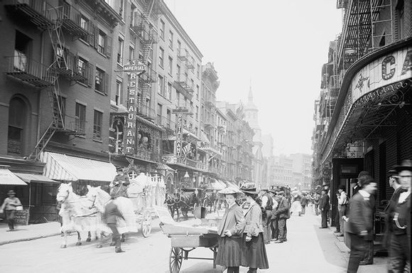
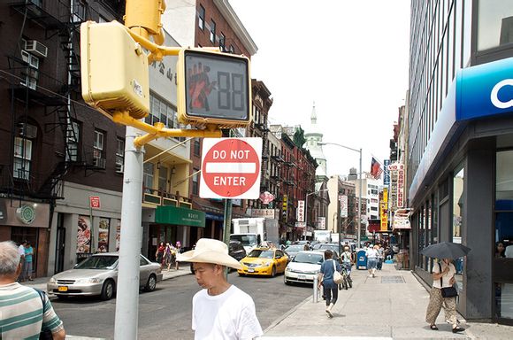
Before & After - Mott Street
The above photo is interactive. Drag the yellow handle in the middle to reveal more or less of the before or after image.
For more than 100 years Mott Street has been the unofficial Main Street of New York's Chinatown. And based solely on these photos all that seems to have happened in those 100 years is the installation of a crosswalk light. Other than that, the block is startlingly unchanged. The majority of the buildings on the west side of the street remain with only a few new coats of paint and some new windows. Even the brand new stuff like the shiny Citibank building on the east side loosely mirrors the original building with its wrap-around signage.
Before & After - Madison Square Park & Flatiron Building
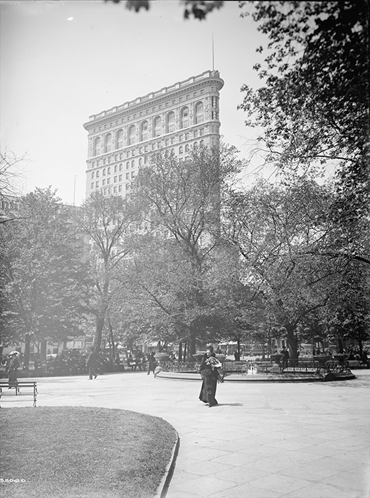
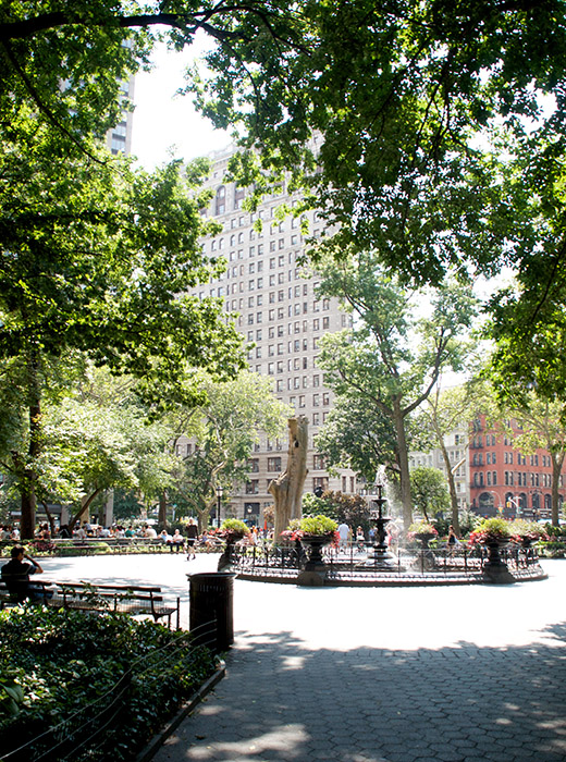
1905
The above photo is interactive. Drag the yellow handle in the middle to reveal more or less of the before or after image.
If you've ever stood and waited for an order at Shake Shack in Madison Square Park, you may have noticed a large dead tree with its own little fenced-off patch of land. Some may have written it off as just another in a long line of crazy art installations in the park, but they're wrong: It really is just a big dead elm tree in the midst of an otherwise immaculately maintained park. The reason it's still there, according to a 1995 New York Times article, is as a nest for squirrels.
Now, what I love about today's photo is that we have an opportunity to see the tree before it was trimmed back to its current sad state; it's right there near the middle of the image. Of course the trunk is noticeably bulkier in the modern image, but you can clearly see the original tree in the 1905 photo as it follows the same path. You can also notice that the fountain changed. The current one is a modern reproduction of the original from the mid 1860's. Apparently that original fountain didn't make it to the early 20th Century.
This photo also features the Flatiron building. I hear it's quite popular.
Before & After - Broadway, The Canyon of Heroes
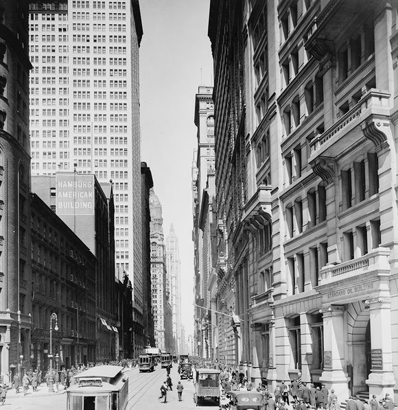
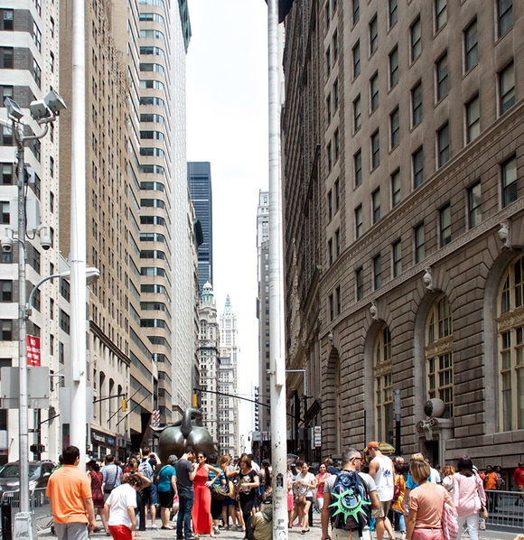
The above photo is interactive. Drag the yellow handle in the middle to reveal more or less of the before or after image.
Though Broadway enjoys many different nicknames as it meanders up Manhattan, the most famous might be "The Canyon of Heroes". Between Bowling Green and City Hall the street is both narrow and flanked by very tall, classic-looking office buildings. This combination creates one of the most famous stretches of road in American history. Serving as host to countless ticker-tape parades over the last hundred years, these few blocks typically just serve as a funnel for thousands of tourists who come to gawk at our big bronze bull.
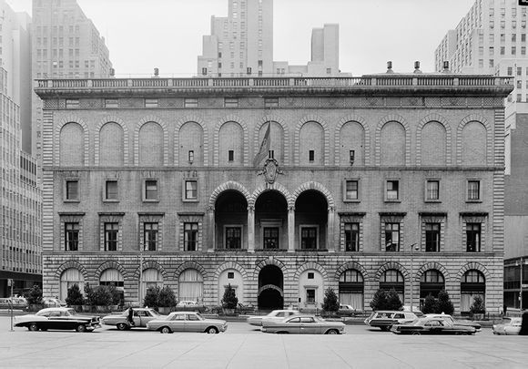
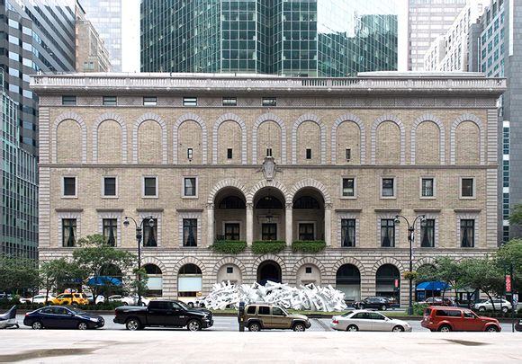
Before & After - City Hall
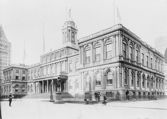
City Hall
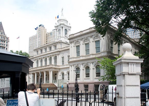
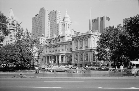
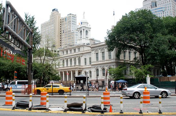
The above photos are interactive. Drag the yellow handle in the middle to reveal more or less of the before or after image.
In the early 1800's the majority of New York City still existed solely below Chambers Street, so it made sense to build the new City Hall on the northern edge of that boundry facing south. Unfortunately for those early planners, the City just kept growing. Now we find ourselves with a City Hall whose back is turned to the majority of its population. (There's a political cartoon in there just waiting to happen.) To make matters worse they didn't even treat the rear of the building with the same respect as the front. The most visible parts at the time were clad in ornate white marble while the back was just simple brownstone. It wasn't until a renovation in the 1950's that the entire building was covered in the limestone that we see today. As a result, the old 1919 photo above is a completely different exterior than what you see in the 1984 and 2013 photos.
Before & After - Gramercy Park West
1934
The above photo is interactive. Drag the yellow handle in the middle to reveal more or less of the before or after image.
When Gramercy Park was first laid out in the early 19th Century, it was mostly a swamp within a larger plot of farmland. Over the next century some of the most consistently expensive buildings in Manhattan would begin to pop-up. The private park – one of only two in the city, the other being Sunnyside Gardens in Queens – is small enough that you can easily see all the way across it from the outside. The park is also the raison d'être for both Lexington Avenue and Irving Place. Samuel B. Ruggles the man responsible for the park and its surrounding plots sought the creation of the new north-south avenues in order to increase accessability to the park.
Today's photo shows #3 and #4 Gramercy Park West and as seems to be the case with most of these Before & After pictures, the story of what's changed is mostly obscured by unchecked tree growth. Still, the 150+ year old buildings look to be in great shape
1894
The above photo is interactive. Drag the yellow handle in the middle to reveal more or less of the before or after image.
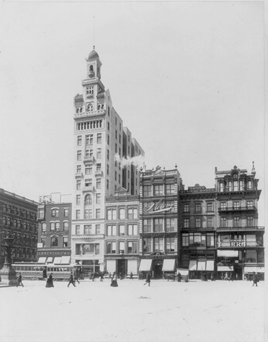
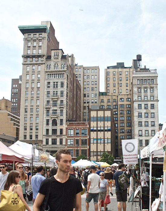
For over 100 years, the northwest corner of Union Square has stood out thanks to its block of six narrow buildings. Appearing not unlike a bar graph, each building rises to a unique height, ranging from one flight up to sixteen. The most storied tower is perhaps The Decker Building - the second from the left in the photo above. Built in the late 19th Century, The Decker originally had a minaret crowning the top. I can't find any firm date, but most sources indicate that it "disappeared" sometime before World War II. "Disappeared" is a strange word for something that must have been documented and observed as being removed. This building was the site of the 1968 shooting of Andy Warhol, which he just barely survived.
The tallest building of the block is Bank of the Metropolis, which is the best superhero name a building could possibly have. Completed in 1903, Bank of the Metropolis passed the Decker Building as the tallest building in Union Square and featured far more classical styling when compared to the eclectic details of Decker.
One building I can't find too much information on is 37 Union Square West - which is the 3rd from the right. It appears to be the same building in both photos, just renovated with an ugly stick, but I can't be entirely sure.
Unfortunately I was unable to correctly replicate the exact angle of the original photo above due to the Union Square farmers market.
Before & After - Manhattan Bridge Archway & Colonnade
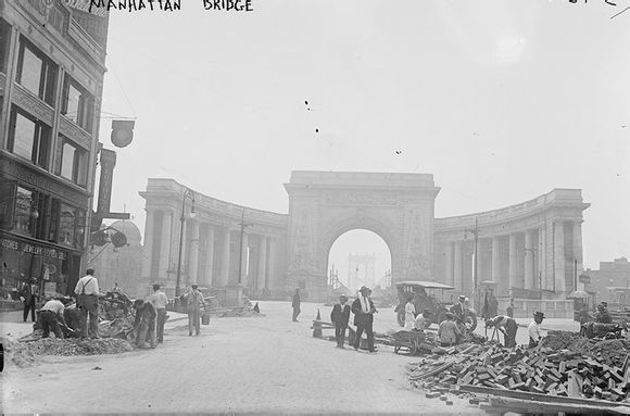
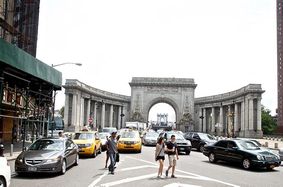
The above photo is interactive. Drag the yellow handle in the middle to reveal more or less of the before or after image.
Built a few years after the completion of the Manhattan Bridge, the arch and colonnade that sit majestically at the end of Canal Street represent a type of architecture the city rarely sees. The arch is part of the awkwardly-named City Beautiful movement in which structures were built "to create moral and civic virtue among urban populations". For many years during the 20th Century the structure was neglected and by the time restoration began in the 1990's, it was covered in decades of grime and graffiti. The arch was designated a landmark in 1975, much to the chagrin of traffic engineers who would have a much easier job moving cars on and off the span if it weren't for that giant stone wall in their way.
Before & After - 23 Wall Street
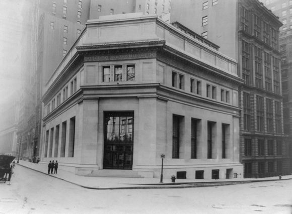
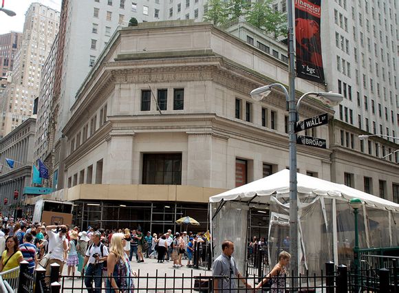
The above photo is interactive. Drag the yellow handle in the middle to reveal more or less of the before or after image.
If you're going to build something directly across from both the New York Stock Exchange and Federal Hall, you better make sure it can hold its own architecturally. At 100 years old this year, I don't think anyone would argue that 23 Wall St - The House of Morgan – is anything less than a staple of the Financial District. A bombing in 1920 left the limestone facade pockmarked from shrapnel. In recent years the classic building and its neighbor have been converted into a condo development.
Before & After - Bowling Green
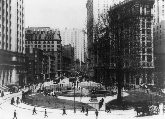
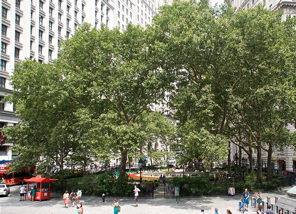
The above photo is interactive. Drag the yellow handle in the middle to reveal more or less of the before or after image.
It may not be the most impressive, but at nearly 300 years old Bowling Green is the oldest public park in the City. Sitting at the southern-most tip of Broadway, the park offers little more than some benches, a fountain and some history. The park and the fence surrounding it are both on the U.S. National Register of Historic Places.
I thought I would be able to get a good photo that matched the angle of the original 1907 image by standing on the steps of the Custom House. Unfortunately from what I can tell, the original image was shot much further to the left than I was able to get.
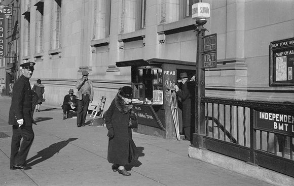
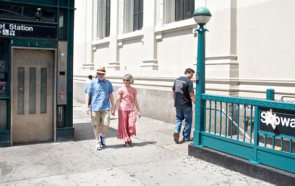
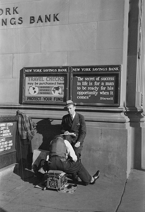
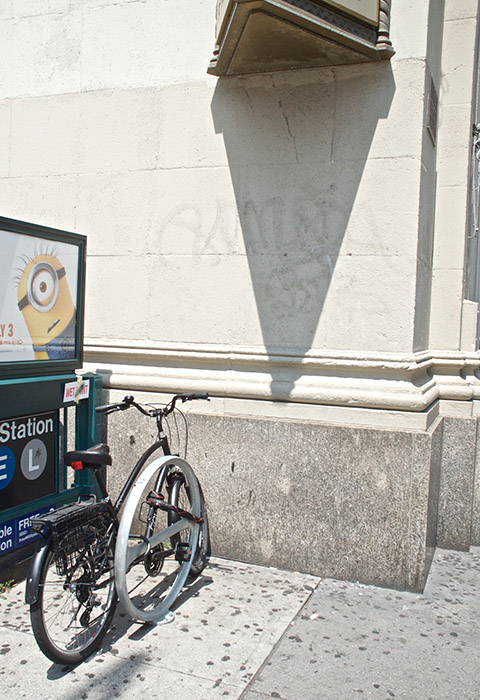
Before & After - New York Savings Bank on 14th Street & 8th Avenue
The above photos are interactive. Drag the yellow handle in the middle to reveal more or less of the before or after image.
When the 8th Avenue/14th Street subway station first opened in 1931, the New York Savings Bank building had already been inhabiting that corner for nearly 35 years. Walking up and out of the northwest stairwell, subway riders are presented with the imposing south facade of the neoclassical structure. Eventually the bank would abandon this location and a series of unimpressive tenants took over. Occupied by a carpet store in the 80's and Balducci's food market in the 2000's, the most recent business to totally not deserve the space is CVS Pharmacy whose aisles of cosmetics and peanut M&M's took up residence in the cavernous hall in 2010.
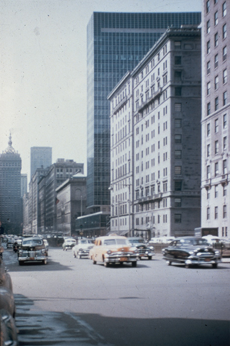
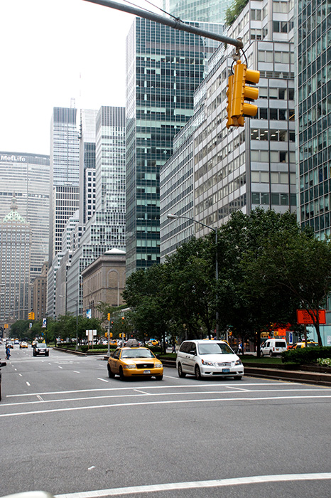
Before & After - Park Avenue and Lever House
![]()
![]()
The above photo is interactive. Drag the yellow handle in the middle to reveal more or less of the before or after image.
Built in 1952, Lever House single-handedly changed how New York City approached skyscrapers. While it wasn't the first building to introduce the International Style to the city (the United Nations Headquarters is responsible for that), it was the most disruptive. Built at a time when, and in a neighborhood where, stone structures represented the brute strength of the organizations who inhabited them, Lever House brought a shiny, futuristic approach to the stuffy avenue. Today the building blends in amongst dozens of other glass curtain monoliths, but it's worth slowing down for, if even just to pay your respects to "the first".
A side note: Part of this Before & After project involves not only identifying where the photos were shot, but when. Many of the cataloged items in the Library of Congress are only partially dated, or provide a range of potential dates. The photo from today's post is listed as "1960-1980". The absence of the PanAm building clearly limits this photo to pre-1964 and the presence of Lever House safely places the earliest year at 1952. A 12-year span is not bad, and it's certainly more accurate than "1960-1980". Though, I still took issue with it being anytime after 1960. Primarily because if you look at the cars, they all appear to be from the early-to-mid 1950's. Now, it's certainly possible that cars from the 50's could be driving in a photo from the 60's, but you'd expect at least one of them to look more modern – especially in a pricey neighborhood like Park Avenue North. But nope, no space-aged, low-slung Chevys or Buicks to be seen. So identifying the cars is a bit of a dead-end. If I knew more about the surrounding buildings, I may be able to narrow-down the date even more, but since I doubt any of them were replaced pre-1960, that's probably a dead-end too. If anyone has some thoughts on when this photo would have been shot, leave a comment below
Before & After - Sutton Place
The above photo is interactive. Drag the yellow handle in the middle to reveal more or less of the before or after image.
Gentrification is the ongoing story of nearly all New York City neighborhoods. Whether it's SoHo in the 1960's or Williamsburg in the 1990's, you can see its effects nearly everywhere you walk. But this is not a new dynamic. Neighborhoods rarely start off as rich and well-developed, and a prime example of that is Sutton Place.
Prior to the 1880's, Sutton Place was continuation of Avenue A. Even after receiving its new name the street was home to middle-class brownstones and the Central Park Brewery. It wasn't until the 1920's that the upper class decided they would like some Upper East Side waterfront property and began building mansions and massive cooperative apartments.
Before & After - Racquet and Tennis Club
The above photo is interactive. Drag the yellow handle in the middle to reveal more or less of the before or after image.
One of the few clubs that still maintains a men-only membership, the Racquet and Tennis Club is a rare sight on Park Avenue. The height of the skyline over the storied street has been increasing steadily over the decades since the Lever House introduced the International Style of architecture to the neighborhood. Wikipedia describes it better than I can:
Today [the Racquet and Tennis Club] performs an important architectural role on Park Avenue as a foil to the Seagram Building and the Lever House and other corporate structures in the glass-clad vocabulary of International Modernism.
Over the years thankfully very little has changed to this classic building. And it's in good company with the Helmsley Building visible to the south.
Before & After - Grand Central Terminal, Ramps
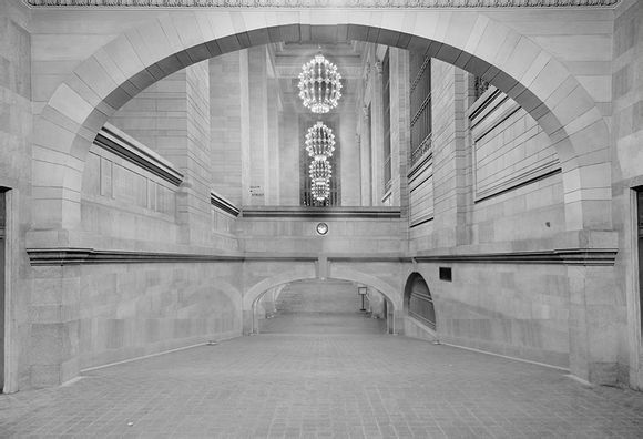
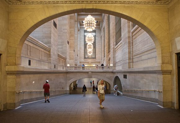
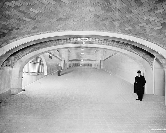
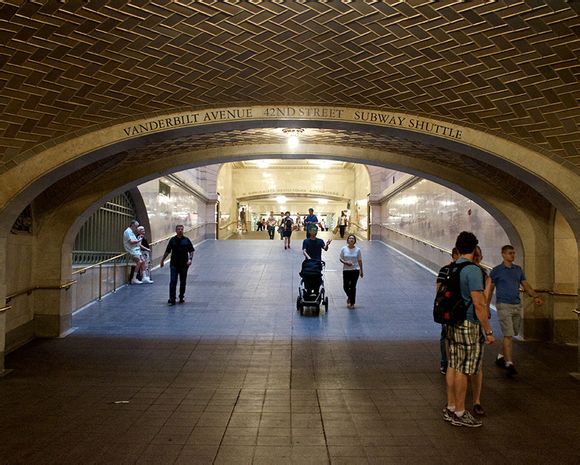
The above photos are interactive. Drag the yellow handle in the middle to reveal more or less of the before or after image.
Grand Central Terminal is a structure of innovation. At 100 years old, we tend to forget how forward thinking the building is. One of those innovations used daily by commuters and tourists alike are the terminal's many ramps. Without stepping upon a single stair you can go from several stories underground to street level in a matter of moments. The ramps that traverse the terminal not only provide an easy mode of egress, but also aid in managing the monumental scale of the building. A space of this size could very easily dwarf its inhabitants, making them feel overpowered and small, minimizing their importance in such a grand space. The ramps mitigate that feeling and provide the ability to navigate Grand Central Terminal with ease.
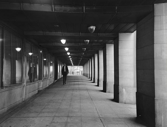
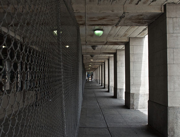
Before & After - Tudor City, 1st Avenue Pedestrian Walkway
The above photo is interactive. Drag the yellow handle in the middle to reveal more or less of the before or after image.
Tudor City on the east side of midtown Manhattan is a fascinating piece of real estate. Sitting on ancient granite cliffs, the buildings overlook 1st Avenue and are divided by 42nd Street. A short viaduct connects the two halves of the community, which remains mostly inaccessible from anything other than 2nd Avenue. Some steep stairs across from the United Nations allow for pedestrian access to the north half of the co-op. Between 40th and 41st Streets, the buildings are actually accessible via 1st avenue thanks to the buildings' sub-basements continuing four stories below their lobbies. Level D as it's known, opens upon a covered pedestrian walkway which in recent years has been mostly fenced off.
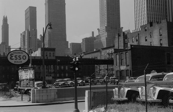
Before & After - Tunnel Exit Street
![]()
![]() 1941
1941
The above photo is interactive. Drag the yellow handle in the middle to reveal more or less of the before or after image.
Possibly one of the best-named streets in Manhattan, Tunnel Exit Street brazenly cuts through several blocks between 2nd and 3rd Avenues. Allowing vehicles exiting the Queens-Midtown Tunnel to evenly distribute onto two avenues between 8 different blocks, Tunnel Exit Street lessens the traffic nightmare that tunnels and bridges often bring with them.
In the 72 years since the tunnel and its exit streets were built, Midtown has grown considerably. The black and white photo above was shot one year after the tunnel opened. You can clearly see the Chrysler & Chanin Buildings dominating the landscape while the surrounding blocks are still filled with classic brownstones which have been long forgotten. In the modern photo, all that remains is the short brick wall and the original lamppost. What used to be parking lots are now massive high-rise office buildings.
Before & After - Park Avenue And The Helmsley Building
The above photo is interactive. Drag the yellow handle in the middle to reveal more or less of the before or after image.
At the center of Park Avenue once sat a lone, towering building known as the New York Central Building. Designed by the same architects who designed Grand Central Terminal, the 35-story tower acted as the main offices of the New York Central Railroad (you can imagine where Grand Central Terminal got its name). Now that building is dwarfed by the surrounding structures, not the least of which is the MetLife Building (formerly PanAm Building), which took over the duties of dominating the Park Avenue landscape in both directions when it was completed in 1963. It also suffered several name changes after the the New York Central Railroad merged with the Pennsylvania Railroad and went bankrupt in the late 1960s (I swear I wasn't just dictating a game of Monopoly – that's actually what happened). Now known as the Helmsley Building, it's still being bought and sold every few years, though luckily its name has remained the same in the past few years.
A few blocks north of the Helmsley Building sits St. Barts Church which has acted as a breath of fresh architectural air since it was built in 1930. This building is actually the third for the congregation, though its iconic triple arched bronze doorways are actually a carryover from the second church which used to sit on 44th Street and Madison Avenue.
Before & After - Grand Central Station
The above photo is interactive. Drag the yellow handle in the middle to reveal more or less of the before or after image.
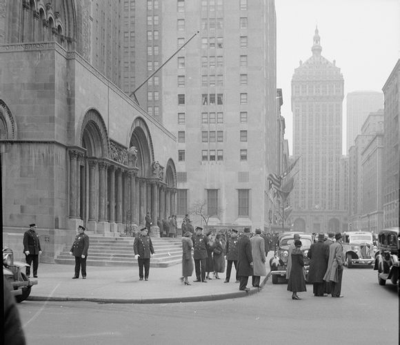
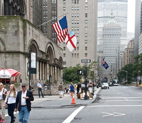
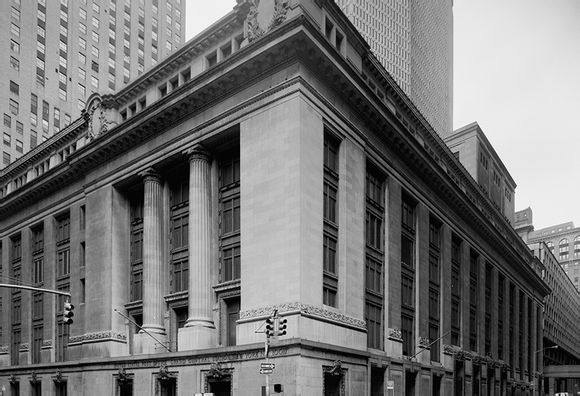
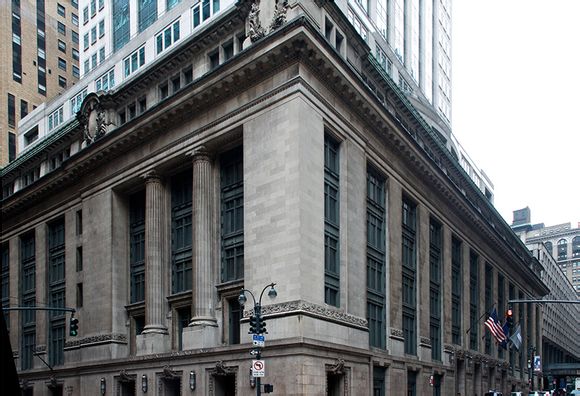
Anyone who knows me knows that one of my most persistent pet peeves is when people erroneously say Grand Central Station when they mean Grand Central Terminal. I've had friends wonder why it bothers me so much since it's often perceived as an innocent-enough mistake with no consequences. "You couldn't possibly confused Grand Central with something else!" Today I present my rebuttal in the form of the above image. What you see there is Grand Central Station – a US Post Office on the corner of 45th Street and Lexington Avenue. I could have also presented a photo of the nearby Subway station – also called Grand Central Station. Lastly, if I had the ability, I would travel back 102 years and take a photo of the structure that was there before Grand Central Terminal, because it too was called Grand Central Station.
The lettering that used to identify the post office as Grand Central Station has been replaced in recent decades, but in the detail shot below you can see proof of my madness.
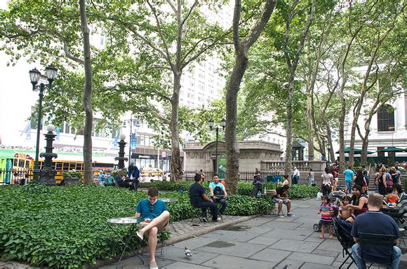
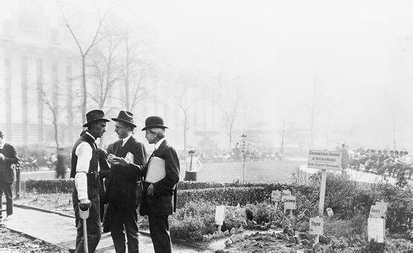
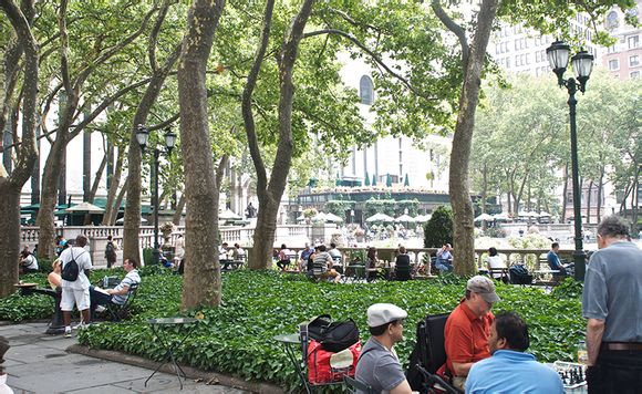
Before & After - Bryant Park
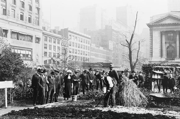
1922
![]()
![]() 1922
1922
The above photos are interactive. Drag the yellow handle in the middle to reveal more or less of the before or after image.
Bryant Park has seen many evolutions over its 150+ years. Before being named for William Cullen Bryant in 1884 it was simply called Reservoir Square due to its adjacency to the Croton Reservoir which stood where the New York Public Library now resides. Even after receiving its modern name, the park has changed wildly over the decades. The photos above show a period during which a demonstration garden was planted near the eastern end of the open space. The west side of the park was perpetually in shadow during this period due to the Sixth Avenue Elevated that had been there since the late 1870's.
上一篇:一生必吃一次的43种全球美食
下一篇:美国各州代表景点